
Welcome to the world of Mergin Maps where data collection is effortless, precise and innovative. With Mergin Maps you can take your QGIS project into the field with you on the mobile device that suits you.

Bringing a wealth of experience burdGIS has helped businesses and conservation organisations get the most from their data. Whether it's surveying the majestic trees of Oxford or the mesmerising megafauna in the Maldives, Mergin Maps is your trusty sidekick in the field.
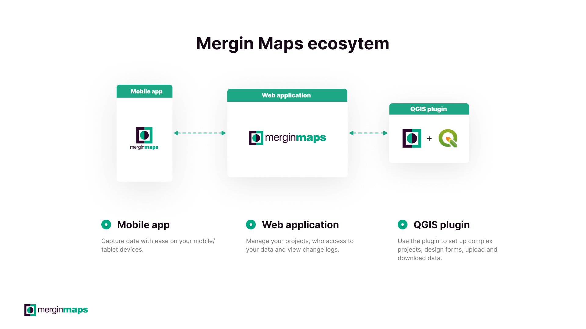
Mergin Maps is not just a data collection tool. It's a comprehensive solution that combines the power of desktop GIS (QGIS) with the convenience of mobile applications (Android, iOS, and Windows). You can design your survey in QGIS to collect points, lines, polygons, photos and any attributes you can think of. After syncing your project to the Mergin Maps cloud, you can let your team collect field data using the Mergin Maps app.
burdGIS offer personalised training courses and support to help you get the most out of Mergin Maps. Whether you're a solo user or part of a larger organization, these courses cover everything from QGIS project preparation to field data collection, form design, background maps, and getting to know the application in a hands-on manner.